

Time: 2¼ hours
Distance: 4¼ miles
Leavening and Burythorpe
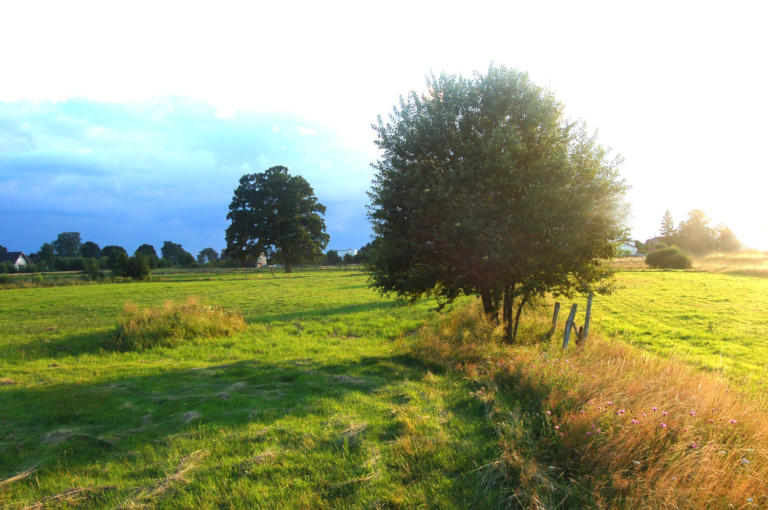
This walk on the edge of the Wolds, south of Malton, connects the two small villages of Leavening and Burythorpe. Traversing varied and undulating farming countryside, it includes a mix of field paths, tracks and very quiet roads.
Is This Walk For Me?
While short, this is a walk with a few challenges. The route is undulating with one long, but not especially steep climb towards the end. There are a couple of stiles and a field where cattle frequently graze (pasture at end of Direction Point 5). While footpaths are reasonably well signed or obvious, there are a few sections where care is needed to stay on route. Parts of the route, at Direction Points 2 and 3, can be a little overgrown in summer. There can also be mud, especially approaching the pasture at Direction Point 5.
Getting There
The recommended starting point is the centre of Leavening, where there’s limited roadside parking near the crossroads and pub. Leavening is 15 miles from York via the A64. Turn off towards Harton, then continue through the village on Malton Lane to the T-junction with High Lane. Here, go right, continuing ahead at a crossroads to Leavening. Alternative starting points are Burythorpe and the secluded carpark at the top of Leavening Brow. If using the latter, continue through Leavening up the hill to the carpark on the right beyond the T-junction. Turn left out of the carpark to pick up the route at Direction Point 7. There are no viable public transport options for this walk.
Refreshments
The two options are the Jolly Farmers pub in Leavening and the Bay Horse in Burythorpe. The former is only open 4-11pm on weekdays (closed Tuesday) and 12.30-11pm on weekends. The Bay Horse is open 11am-11pm daily except Mondays, with food available from 12.30.
Directions
1/Starting from the crossroads in the centre of Leavening near the pub, take York Road (signed Howsham and York). Soon after the houses end, and just before a speed limit sign, go through a gate on the right by a public footpath sign. Walk a few paces left, then go between a hedge to the left and the railed paddocks to the right. Now continue ahead with the hedge to your left, passing through two kissing gates. Keep alongside the hedge, kinking left at one point, to reach the left edge of the wood ahead.
2/ Go over the stile (not the more obvious wooden barrier) partly hidden in the field corner. Walk along the edge of the wood, with a hedge to the left. Approaching the end of the wood, stay near the hedge, heading towards a farm building ahead (bales of straw nearby at the time of writing). Find the stile and go over. Turn left with the building to your right, towards a footpath sign near a food hopper. Here, turn right as signed along the field edge. At the corner, turn right. At the next corner, do not go through the gap but turn left (footpath sign obscured by a bush) along the field edge with a hedge to the right. At the next field corner, find a gate in bushes. Go through it and walk on the enclosed path to another gate. From this, join the access track to the buildings on the left, continuing ahead downhill to a road.
3/ Turn right. Now, walk on this very quiet road for about 900 metres to a T-junction. Here, turn left, but in 40 metres, opposite a telegraph pole, look for an easily missed gate on the right in a hedgerow gap.
4/ Go through the gate and follow the edge of the field near the hedge to the right, heading towards the church on the hillock. At the field corner turn left, but in a few paces, take an indistinct path heading diagonally right up the grassy bank. At the top, keep left on the field edge (church to the left). Reaching the church access road, go ahead on it downhill. Continue to houses and the main street of Burythorpe.
5/ Turn right to walk through the village, passing the Bay Horse pub on the left. At a sharp right bend, keep ahead on a road marked ‘unsuitable for motors’. Soon cross a stream on a makeshift bridge beside the ford. Continue on what is now a rough track, keeping ahead where another track joins from the left. Where the track divides, keep right between hedges to a gate. Go through this and follow the right edge of the large pasture heading towards another gate.
6/ Once through this gate, the route is obvious on a mostly enclosed track which ascends the hillside. Continue upwards, a little steeply nearing the top, to reach an open area and a gate. Go through this to a road at a T-junction.
7/ Here, turn right downhill on the road towards Leavening (if you started from the Leavening Brow car park, turn left after the gate to return to your vehicle). Stay ahead on the road into the village to arrive back at the pub and crossroads starting point.
What To See
Both Leavening and Burythorpe have a mix of old and new buildings. Burythorpe’s church, on its hilltop outside the village, is a Gothic Victorian construction. On the hillside promontory to the left of the track ascending Leavening Brow is a motte-and-bailey earthwork, the site of a medieval timber castle. The track climbing Leavening Brow has a varied flora. There are extensive views at several points on the walk, especially on the ascent from Burythorpe, but also towards the end of Direction Point 2 and near Burythorpe church.
Disclaimer
Walks are undertaken at your own risk. Due care must be taken in following the walk, particularly after poor weather. Whilst every care is taken in compiling the description, changes may have occurred since publication. Neither the walk author nor Your Local Link can accept any responsibility for errors or omissions.



Add a comment