
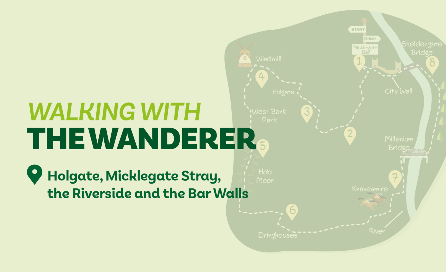
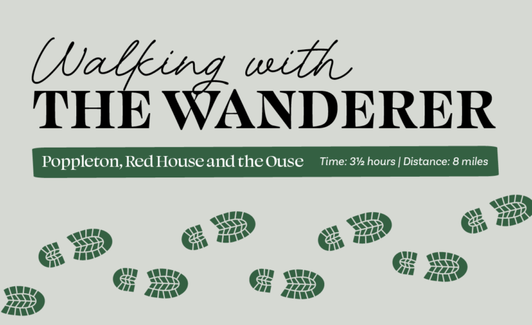
This semi-urban walk weaves its way from the city centre to Holgate before passing a preserved windmill to reach West Bank Park. It then heads over the lesser-known part of Micklegate Stray, Hob Moor, to reach the stray’s more frequented expanse, the Knavesmire. Skirting the racecourse complex, it reaches the river —which is crossed on the Millennium Bridge. New Walk is then followed to Skeldergate Bridge, after which the walls are ascended to the return to the Micklegate Bar starting point.
Is This Walk For Me?
This is a short and easy walk. There are no stiles and only a few minor slopes, but there are several sets of steps. Much of the route is on hard surfaces but Hob Moor can be muddy, and the riverside section will be impassable at times of flood.
Getting There
The starting point for the directions is Micklegate Bar, but the walk can begin from any point on the route. Nearby bus stops to Micklegate Bar in Blossom Street are served by routes 1, 3, 4 and 5, amongst others. Nunnery Lane is the nearest car park.
Refreshments
There are plenty of opportunities near the start but fewer directly en route. The Cross Keys pub and Café at no12 in Dringhouses are conveniently situated at the halfway point.
What To See
The restored and working Holgate Windmill has regular open days (see https://www.holgatewindmill.org/events). West Bank Park is one of York’s lesser-known parks but has a range of features and rare trees that date back to its time as a nursery. Hob Moor is ancient grazing land and a local nature reserve (see https://friendsofhobmoor.org.uk/). New Walk provides a tree-lined return to the city. Baile Hill and the city walls are less frequented parts of York’s historic defences.
Download your FREE digital walk map!
1. Starting with Micklegate Bar (gateway) behind you, go left at the traffic lights, having first crossed to the far side of the road (Nunnery Lane). At the end of the wall take the wide alley right continuing ahead across a street. At the end of the school playground go half-left across the green and cross the road at traffic lights. Go through the wooden gate opposite and walk through the allotments on the main path to a barrier at a road.
2. Cross and descend the steps opposite, then follow the tarmac track beside more allotments. At the road, turn right passing the sports pavilion to reach the main (Tadcaster) road. Cross and go right for a while, but immediately after the Elmbank Hotel turn left (Driffield Terrace).
3. In 40 metres, keep ahead (Love Lane) on a path that soon ascends steps and crosses the railway. Over, keep ahead to a T-junction. Turn right to another T-junction (Holgate Road). Turn left, cross at pedestrian lights and take the foot/cycle path a few metres back on the right (walking behind the Fox pub). When this parallels the road, continue until you reach a set of bollards, then cross the road with care and walk up Windmill Rise. At the windmill, keep left and find the narrow path to the right of house no. 39. This leads to a road.
4. Turn right, but in 60 metres go into West Bank Park over the road. Follow the main path up steps before passing between stone pillars. Stay on the path with trees to the left and the lawn to the right, until you reach a playground. Turn left and exit the park through a gate. Turn left (Hamilton Drive). Take the second right (Campbell Avenue). At the end of the road go half-left over the crossing street, taking a signed path between houses.
5. Go beyond the bridge/barrier following the tarmac track to a metal post. Here go straight ahead (not half right) over the grass aiming for a gap in the distant hedge. Go through the gated gap, following the worn path over the grass field towards another gate. Go left through the gate, but in 20 metres go right on Railway View. At the crossroads turn left, walking up the slope and over the railway bridge to a T-junction with the Cross Keys pub to your left.
6. Cross the road to the church and turn right for 100 metres, then turn left after the hotel (Cherry Lane). Follow this, keeping right to the Knavesmire. Cross the racecourse and keep ahead aiming for a distant railings gap. Cross the racecourse again and go towards the brick building left. Join the paved access road going left but in 75 metres, opposite a racecourse entrance, turn right to find a cycle track. Follow this left near metal railings to a road. Cross the road and turn left for 125 metres to the cycle track sign. Turn right.
7. Follow the track to the river and turn left. Continue to the Millennium Bridge. Ascend the steps and cross over. On the far side, turn left and walk alongside the river, ignoring all ways off right, to the obvious Blue Bridge. Cross and continue beside the main river to go under a road (Skeldergate) bridge.
8. Turn right up the steps and go right over the river. On the other side take the gate leading onto the city wall climbing steps. Now follow the city wall, passing over a gateway (Victoria Bar) back to the start.

Add a comment