
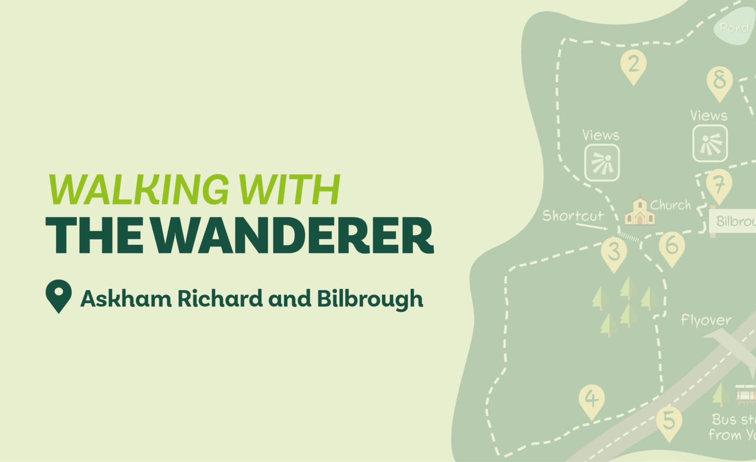
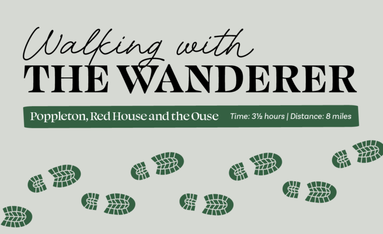
Askham Richard and Bilbrough
Just to the north of the busy A64, lies one of the most varied areas of countryside to sit within a few miles of York. Starting from the green at Askham Richard with its duck pond, this walk uses lanes and tracks to teach Bilbrough. The later stretches offer striking views across the fields to the distant Minster. It would be possible to divide this walk into two separate walks by turning left at Direction Point 3 (if starting from Askham Richard) or by turning right at Point 6 (if starting from Bilbrough). It is also possible if you start by bus from York.
Is This Walk For Me?
Although this is a short walk, there are a few minor challenges. Some paths are lightly trod and unsigned. There are also a number of stiles and a couple of short climbs. Cattle may be grazing in the field beyond the avenue in Direction Point 2. Some of the walk is along (mostly quiet) roads. The route alongside the A64 is on a wide cycle/foot path away from the traffic. Mud is possible on the field paths.
Getting There
The recommended start point is Askham Richard near the Rose and Crown pub where there is roadside parking. If you’re using public transport, the best option is to take a Coastliner bus from York Station to Bilbrough services. Walk back from the bus stop and cross the flyover, then turn left on the cycle/foot path on the opposite carriageway to start at Direction Point 5. Bus 37 also runs direct to Askham Richard and Bilbrough several times-a-day (not Sunday) from York station.
Refreshments
At the time of writing, both the Rose and Crown in Askham Richard and the Three Hares in Bilbrough are closed. There is a Greggs outlet in the service area alongside the A64 at Direction Point 4.
What To See
The main historical feature on this walk is the Fairfax Tomb in Bilbrough Church. Otherwise there’s the countryside to enjoy, plus the views from the minor peaks either side of Bilbrough.
Download your FREE digital walk map!
Walk Directions
1. With the Rose and Crown pub behind you, go right on the road. Bend left at the end of the pond and leave the main road to the left on Mill Lane. Follow this hedged lane, which carries virtually no traffic, for about 600 metres until it bends left to a road at the end of a small copse.
2. Turn right and follow for about 350 metres, ignore a right turn after about 300 but 50 metres beyond this, turn left on an unsigned road. Continue, passing The Normans weddings venue. About 200 metres after this, where the road bends right, go left into a field (currently protected by a low log barrier) on an unsigned footpath. Head towards trees and pick up a narrow earth path running between them. Walk through the tree avenue, keeping left as it reaches its end at a low stile. Climb over the stile, then turn halfway to the left towards the right of a solitary tree until you reach the crest of a hilltop. Continue along the grass following a faint path towards a gate that is to the right of a short wall. Continue through the gate on an enclosed track to a road.
3. Turn right downhill. Stay on the quiet road, ignoring a right turn, until you see a house on the right. Go through the double metal gates opposite the house to follow an unsigned grassy bridleway that is running between the hedges. Remain on this path, which eventually opens out on the right, until you reach a T-junction with a crossing track. Turn left and follow this for about 400 metres to reach a pond, houses and barns, and the A64 dual carriageway.
4. Turn left on the footpath/cycle track (if using the Coastliner buses the return stop to York is here). Continue past the services complex.
5. About 150 metres beyond this, look out for a hard-to-spot unsigned stile in the hedge on the left (it’s directly opposite a ‘H’ hydrant sign on the other side of the dual carriageway). Go over the stile and walk ahead with a hedge to your left, soon climbing a short slope. At the top of the field turn right and follow the wood edge to the left around a corner by a telegraph pole. Continue through a redundant barrier/stile but 30 metres beyond this, go left through a gap. Next follow the obvious path over some rough grass, then head into trees. Squeeze through a gap in the churchyard walls to cross the yard and reach Bilbrough’s main street.
6. Turn right down the street. At the end turn left. Where the road straightens after a right bend take the signed bridleway on your left to continue between hedges until you reach an open area with a seat.
7. Here you’ll turn right and pass to the right of a large tree. Continue along the left edge of fields going over two stiles. Just before a lone tree ahead of you, follow the path left as it goes down a few steps to drop into a lower field. Go ahead, with a hedge to your right, downhill along the field edge. Maintain the same direction in the next field with a hedge still to your right until you reach a road.
8. Turn right on the road. In 250 metres turn left towards Askham Richard. Continue by the roadside trees to the village green and start-point.

Add a comment