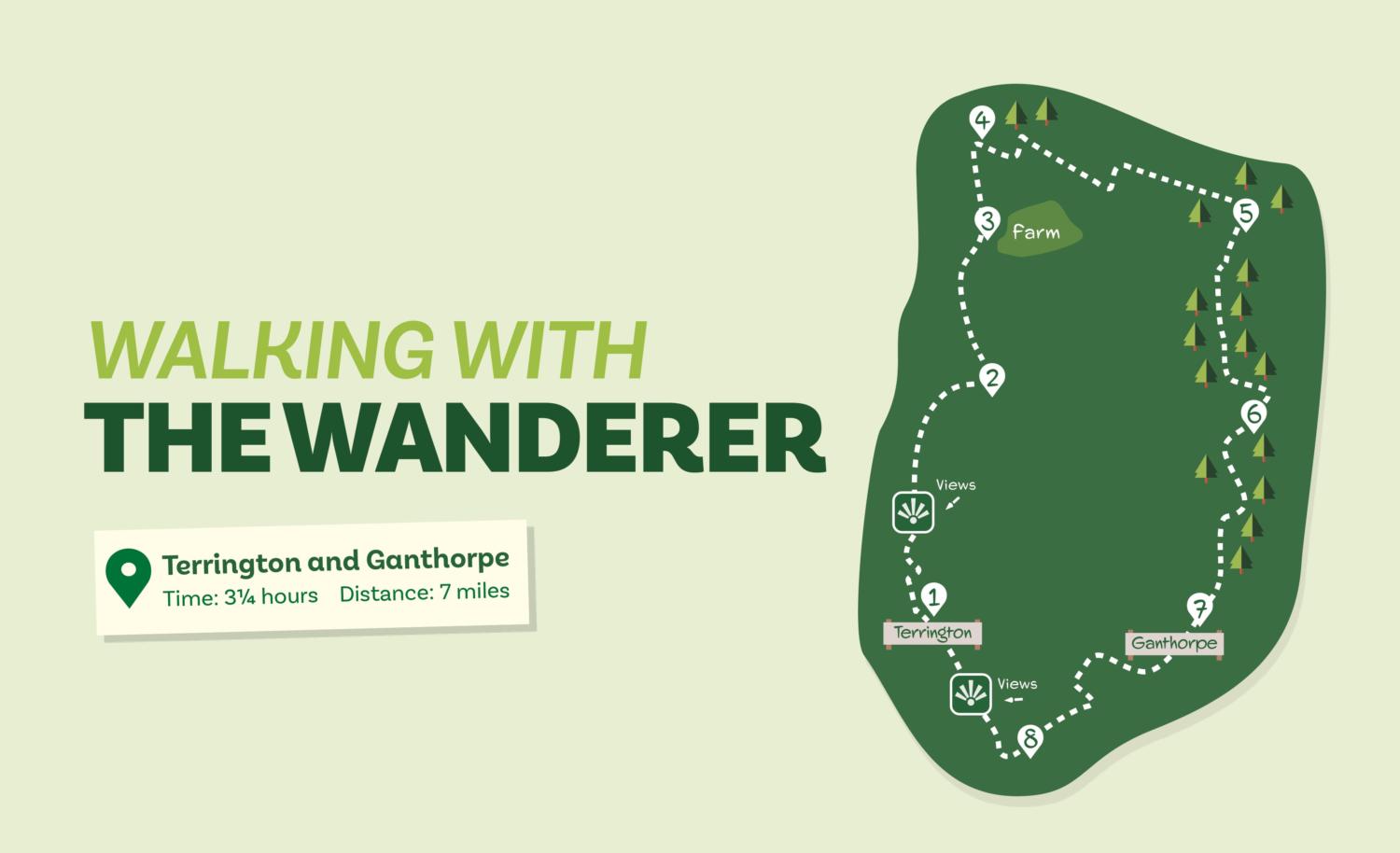
Exploring the Howardian Hills countryside to the north and east of Terrington, this walk traverses a pleasant mix of woodland, pasture, and arable farmland.
Is this walk for me?
There are quite a few climbs on this walk but most are short and relatively gentle. The route is generally clear and well-signed except for some places at Direction Points 2 and 3, and in the woodland at Direction Point 5. Much of the route is on potentially muddy bridleways. There are no stiles. Cattle may be grazing in some fields.
Getting there
The recommended starting point is the shop/tearoom in the centre of Terrington where roadside parking is available. Terrington is 15 miles from York via Strensall and Sheriff Hutton, or 17 miles using the A64 and turning off before Whitwell-on-the-Hill. It’s also possible to start the walk from Ganthorpe where limited parking is available by the green. There are no feasible public transport options to Terrington from York.
Refreshments
Terrington Stores and Tearoom at the start point are open daily. Yorkshire Lavender’s Tea Room is nearby but is open from April to September only.
What to see
The main attraction of this walk is the varied countryside. The walk passes through several areas of deciduous woodland and an expanse of rough grassland, both of which are valuable wildlife habitats. Terrington is an attractive stone-built village typical of the Howardian Hills.
Printable directions and map
Directions
1. From outside the shop in Terrington, cross the road and go down Church Lane almost opposite. Pass the church continuing ahead on a narrow path left of a house. Go through the gate and walk ahead to a footpath sign at a wall corner. Remain ahead on a grass terrace, then go down steps and walk across a field towards a post. Continue ahead as signed over open fields at first on a grassy strip then on an earth path. At a hedge, turn left but in 20 metres turn right with a hedge now left, continuing to a metal gate.
2. Through the gate go half left following wheel tracks towards a footbridge. Over the footbridge, keep close to the stream on the right. At another bridge, cross but then head left alongside the stream into a scrubby area. Go through a gate to continue by the stream, but at a hedge turn right following a faint path with rough grass/shrubs left and a field right.
3. At a footpath sign by a gate, take the left option uphill alongside a wire fence. Keep the farm buildings to the right, staying in the field soon veering left to go downhill keeping close to the telegraph poles. Continue through scrub and across the grass to a gate in the left field corner.
4. Through the gate, turn right on a grassy path, continuing alongside an open field right. At an earth track go left (signed ‘Fryton’). Just beyond an oak tree, turn hard right on an unsigned track uphill between fences. At the top, take the left of two tracks ahead (not sharp left). Continue to a metal gate after which, continue on a track to a T junction.
Turn left but in 150 metres turn right on a grassy path across an open field. Continue on the grassy track which eventually curves left, then goes into trees.
5. At the end of the trees turn right on a grassy path downhill with trees on the right. Keep going to enter the woodland remaining on the main (stoned) track. At a staggered track crossing, go left, then right downhill. About 100 metres beyond this, where the main track, curves sharp left, take the narrow footpath ahead uphill into trees. Where this meets a wide track turn left. About 200 metres later, at a blue arrowed post go right downhill on a narrow path through trees.
6. At the road, turn right but in 25 metres turn off to follow a signed bridleway. Continue alongside the wood left for 750 metres, then go through a gate and turn right alongside a fence. Follow the grass track as it curves left across the field corner, then keep ahead between fences. In a small field, go straight ahead to a metal gate ten metres below a wooden gate. Follow the path through trees passing a pond. Remain in the trees then pass a house to the right and go uphill. Keep right at the tarmac lane to reach the small green in Ganthorpe.
7. Cross the road and take the signed track opposite. Ignore the footpath at a gate on the left continuing on the track through a right bend. About 75 metres beyond this, turn right off the track to walk alongside the hedge on the right with a large field left. At the field corner, turn left as signed. At the next corner keep left (ignore footpath right), still on the field edge, but in about 50 metres go right over a ditch to walk alongside a hedge/ditch left, continuing to a tarmac lane.
8. Turn right on the lane ignoring all paths off. After passing a cemetery and sports area left, keep ahead at houses then go right to arrive back at Terrington with the shop/café on your left.
Disclaimer: Walks are undertaken at your own risk. Due care must be taken in following the walk, particularly after poor weather. Whilst every care is taken in compiling the description changes may have occurred since publication. Neither the walk author nor Your LocalLink can accept any responsibility for errors or omissions.


