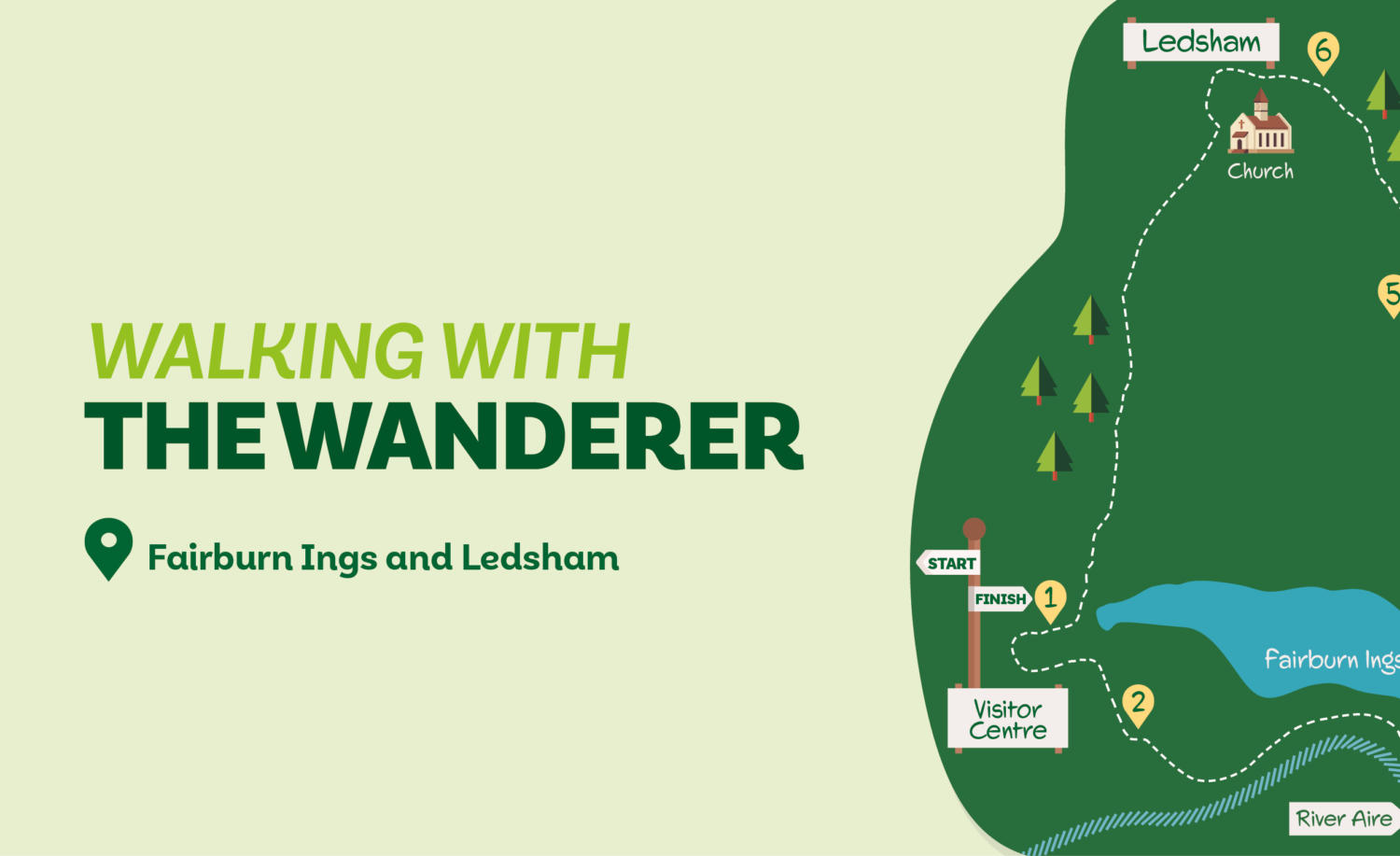
Fairburn Ings and Ledsham
A good proportion of this walk is in the RSPB’s Fairburn Ings Nature Reserve, where if you’re lucky you might even spot a Kingfisher. The remainder traverses the undulating countryside found to the south of Ledsham. Despite the proximity of the A1(M), the area is surprisingly quiet and rural. Entry to Fairburn Ings is free unless parking.
Is This Walk For Me?
This is a relatively short and undemanding walk. There are a few ups and downs but none are steep or long. Paths are generally well-demarcated although some care is needed to keep on route between Direction Points 4 and 5. A few sections can be muddy and slightly overgrown. There are two stiles.
Getting There
Fairburn Ings is 25 miles from York via the A64 and A1(M), leave at junction 47 to take the A656, then follow Back Newton Lane to the reserve. The most convenient starting point is the RSPB carpark at Fairburn Ings Nature Reserve. However, there is a charge for non-RSPB members. An alternative option is the roadside parking near the church in Ledsham. There are no feasible public transport options from York.
What To See
The main attraction is the large Fairburn Ings Nature Reserve, which you’ll see half of on this walk. All Saints Church in Ledsham is one of the oldest in Yorkshire, dating from well before the Norman Conquest.
Refreshments
Light refreshments are available from the shop at Fairburn Ings Visitor Centre. Alternatively the Chequers Inn at Ledsham is open from 11am daily and serves food for lunch and in the evenings.
Download your FREE digital walk map!
Directions
1. From the carpark, take the path towards the visitor centre (if starting from Ledsham, turn right into the carpark from the entrance gates). Unless entering the visitor centre, follow the path left with the building to the right. Keep right at a junction following signs to the Pickup Hide (the boardwalk to the left is currently closed – when reopened follow it left, then turn left when a hard surface path is met — this will shorten the route by several hundred metres). Go left before the hide (not up the ramp) following the path as it curves left. Continue on the clear path, going right at a metal gate and a wooden screen, up a gentle slope.
2. After approaching a metal gate near the top of the slope, turn left (signed Riverbank Trail). The route now continues on this trail, ignoring all paths off. Initially the path goes through an area of fire damaged scrubby trees, then it’s atop a bank in young woodland with the river to the right and a large lake left. Eventually, after well over a mile, the path reaches a kissing gate.
3. Turn left here away from the river on a stoned track through trees, but keep the lake visible at intervals to the left. At a metal gate continue on a track which becomes a tarmac street. Continue to the road on the edge of Fairburn village.
4. Turn left on the road. In about 200 metres just before the road goes downhill, cross and turn right on the tarmac towards Beckfield Lane. Where this divides in about 100 metres, go right. Continue ahead on a narrow path after a house entrance. At the field, follow the narrow path between wire fences. Where this path ends, keep to the left edge of the large field. You’ll meet a kissing gate that will give you access to a large grassy field; initially keep to the top of the slope beside a wire fence then follow the hedge to the right. After about 250 metres the grassy path splits by some larger trees on the right. Here head left, down the slope towards a gate that will be visible in the trees ahead.
5. Cross the strip of woodland to a stile. Go over and move half-left on a faint track, this will take you over the grass field where you can follow the hedge. Continue as the field narrows but watch out for a kissing gate on the right. Go through this to follow a clear path in the trees, soon reaching a path fork. Go left down-slope to follow the wood edge to a stile. After this keep near the field edge right by a line of beech trees and turn left to reach a road. Turn left on the road into Ledsham.
6. Stay on the road as it sharply bends left, bringing you to the church (to visit, take the higher pavement and enter the churchyard). About 20 metres beyond the left bend, stop following the road as it moves right but go ahead (left) on Newfield Lane. (If starting from Ledsham by the main church entrance, go ahead then right down Newfield Lane). In about 100 metres go left (not ahead into Manor Garth) on a road marked ‘Private Road Bridleway Only.’ Continue as this becomes a well-defined track, at first over open fields before moving to the edge of woodland for more than a mile until you reach a road. Cross the road but take the track slightly to the left across the rough grassy area. This leads to another road and the entrance to Fairburn Ings carpark (if starting from Ledsham continue from Direction Point 1).
Disclaimer: Walks are undertaken at your own risk. Due care must be taken in following the walk, particularly after poor weather. Whilst every care is taken in compiling the description, some changes may have occurred since publication. Neither the walk author nor Your Local Link can accept any responsibility for any errors or omissions.


Add a comment