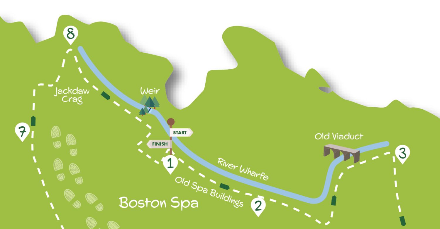
This walk of about seven miles circles the large and very salubrious village of Boston Spa. Starting in its main street it drops to the river Wharfe, following it downstream and passing the converted spa buildings. Heading into the countryside it goes under an old railway viaduct to follow the line of an old Roman road (Rudgate) into farmland. A pleasant trundle across fields leads to the village of Clifford with its grand Catholic church. Saving the best to last, the final stretch returns to the river. Climbing over tree hung Jackdaw Crag the route comes to the impressive weir before finishing in the village’s main street with its fine magnesian limestone buildings.
Care should be taken where the path runs close to the river especially near Jackdaw Crag and the weir. If the river is high some sections of the riverside may be impassable. Apart from this, except for the track at Point 3 in the Directions, the route is relatively free of serious mud and water.
Don’t forget to download your free print out of the walk down below.
Getting There
By car Boston Spa is about 15 miles from York via Tadcaster using the A64 and the A659. Access by public transport from York is tricky. One option is to take the frequent Coastliner buses to Tadcaster to connect with the infrequent 77 bus that runs through Boston Spa.
An alternative is to travel on bus 412, which runs roughly every two hours, to Wetherby and then take bus 7 departing Wetherby every 30 minutes. If driving park considerately on the roadside in Boston Spa as the public car park is limited to two hour stays.
Refreshments
There’s a good selection of bars and cafés in Boston Spa’s main street.
1. Start on Boston Spa High Street at the junction with Bridge Road near the prominent former hotel building now housing a Costcutter supermarket (if travelling by bus, alight just beyond Costcutter and turn back in the direction of travel to the junction). Go down Bridge Road and take the signed path to the right leading to the river. Continue ahead following the river downstream with houses up above to the right soon passing the old spa bath buildings. Follow the river to a kissing gate into a field.
2. Continue, crossing a bridge over a tributary beck, then coming to another kissing gate with a wooded bank to the right. Climb steps and at the top, with the river down to the left, proceed on a narrow fenced path to another gate. Pass under the arch of the disused railway and keep by the river in the field beyond eventually coming to stile.
3. Climb and turn right (do not go over the stile opposite) going into the trees (if the way here is flooded do not cross the first stile but go along the field boundary until a collapsed fence gives access to the path beyond the flooded area). Continue on the tree fringed narrow path which widens into a track (numerous puddles here after wet weather). After about 800 metres the track reaches a main road.
4. Cross the road and go up the minor road opposite. In about 300 metres at a crossroads turn right down Watson’s Lane. Where the lane splits keep ahead between properties to climb steps over a short wall. Go ahead on a grass path to a kissing gate then keep alongside the stream to a wooden stile. Over this turn right up a track but in 20 metres turn left alongside a wooden fence. Follow the path as it swings right and left along the field boundary and, as signed, into bushes to another kissing gate.
In the field beyond keep right to the corner but ignore the gate and turn left down the hedge to a gate by a footpath sign. Go through this and follow the wooden fence on the right to another gate.
5. Turn right here on track but in ten metres turn left on another track with a hedge to the left. Follow the track as it bends left through a barrier but ten metres beyond this turn right on a path between fields. Keep ahead as the path becomes hedged and fenced swinging slightly left then widening to a track with gardens on the right before reaching a road. Turn right here following the road as it bends left and right passing a ‘Welcome to Clifford’ sign. Continue ahead as road narrows to T junction.
6. Turn left passing the Catholic Church and then ignore the road signed ‘Boston Spa’. Where the road bends left at War Memorial turn right onto Willow Lane. You now continue on this lane which becomes Clifford Moor Road for nearly a mile leaving Clifford, passing a school and entering the outskirts of Boston Spa to reach a crossroads with the main road.
7. Cross straight over the main road to go down Leys Lane. Follow the hedged tarmac lane but at a no through road sign turn right, still on tarmac down to a dip. Take the bridleway signed ‘Deepdale’ down a small valley with a stream on the right. Approaching the river, cross the footbridge over the stream and go steeply uphill. Keep on up steps ignoring a path to the right.
8. You now continue on a path high above the river to the left (take care, steep drop in places) soon with houses, including a large new development set back from the path, away to the right. Eventually, with the weir prominent to the left, the path drops down to a junction with a bridleway on the right (the weir can be approached by paths to the left). Go up the bridleway (Holgate Lane) in the gully to emerge by the church at the main road (High Street) where you turn left back to the starting point.
DISCLAIMER: Walks are undertaken at your own risk. Due care must be taken in following the walk, particularly after poor weather. Whilst every care is taken in compiling the description changes may have occurred since publication. Neither the walk author nor Your Local Link can accept any responsibility for errors or omissions.


Add a comment