
Time: 3½ hours
Distance: 8 miles
Poppleton, Red House and the Ouse
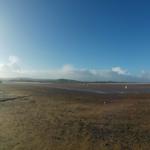
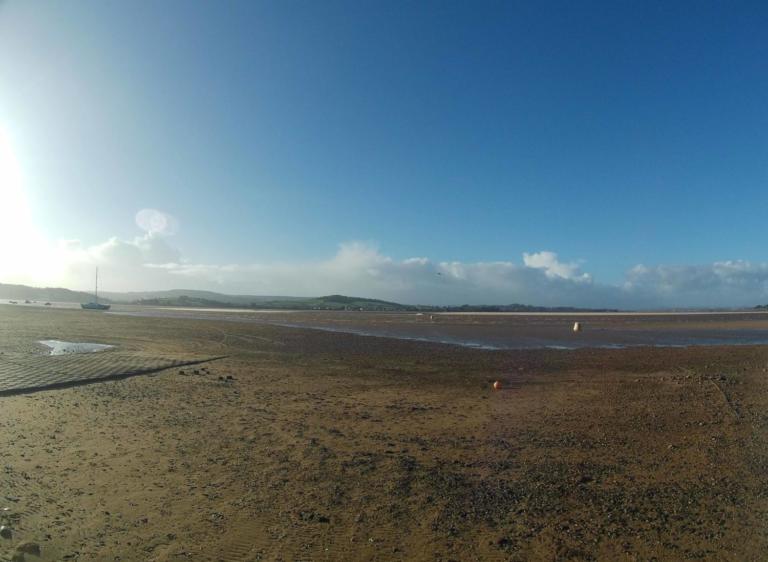
This walk explores the countryside west of Poppleton, between the Ouse and the A59. With just a few farms and scattered houses, this is one of the quietest and least frequented areas close to the city. About a third of the route is alongside the river, with most of the rest over farmland, mainly on tracks and lanes.
Is This Walk For Me?
Although relatively long, this is an easy walk. There are no hills or stiles, and much of the route is on tracks or lanes with hard surfaces, making it suitable for any time of year. If the river is in flood, the route may be impassable between Red House and Poppleton.
Getting There
The recommended starting point is the green in Upper Poppleton, where considerate roadside parking is available. Bus no.10 runs regularly to Upper Poppleton – alight at The Green stop. An alternative public transport option is to take a train to Poppleton and walk 400 metres on Station Road to the start point. If driving, it is also possible to start near the river at Nether Poppleton (parking area at Direction Point 6), or close to the entrance to Red House (Direction Point 4, very limited parking spaces).
Refreshments
Upper Poppleton has two pubs. The Lord Collingwood is open daily, but not until 4pm on Mondays to Wednesdays. The White Horse is also open daily except Monday (4pm opening on Tuesdays). The popular Poppleton Social in the Poppleton Centre has an extensive menu and is open every day, but closes at 4pm on Sundays and Mondays.
Directions
1/ Starting from Upper Poppleton, and with the Nisa store and White Horse pub behind you, take the road opposite (Hodgson Lane), keeping the maypole to your left. Walk on the right-hand pavement, pass the Lord Collingwood and in about 200 metres, and where the pavement ends, turn right into Westfield Lane. Continue, soon leaving the houses, on the narrow tarmac road, eventually reaching a crossroads.
2/ Go straight over, still on tarmac. Pass a telecoms mast continuing ahead. Keep going over a dip/beck, but 200 metres beyond this, fork off right on a stoned track with a wooded area to the left. In a further 700 metres, with a house/farm buildings to the right, do not take the signed footpath right, but go through the wooden gate ahead into a grass field.
3/ Keep to the field’s right edge. At the corner, turn left with a fence to the right until you reach a metal gate. Go through and continue to a tarmac drive. Take this for a short distance, but where this goes left, be sure to take the earth track to the right (yellow arrow). Follow this, soon going between hedges and bending left to return to the drive. Turn right and continue on the drive for just over a kilometre to a T-junction.
4/ Turn right (not ahead through an enticing gate opposite) on the hedged lane. Go under pylons, ignoring all turnings off. In about 800 metres, pass the Park Farm complex, soon after which the lane bends right with woodland to the left. Where the tarmac splits, keep ahead into Red House Estate on its access drive. As the drive bends right, look for a ‘Permissive Footpath To River’ sign on the left. Take this, soon going through a gate. Where the path forks, keep right on a raised bank near trees/bushes to the right. Continue to a path junction in a small grassy open area.
5/ Turn right, passing between gateposts with paddocks and the buildings of Red House to the right and the river to the left. (To view the water treatment works lagoon, turn left for 100 metres, then retrace your steps). Now, continue beside the river, soon passing through a gate, then with youngish trees to the right. Beyond this, the path trends slightly away from the water onto a bank with a field at the right. It then enters a slightly overgrown area to arrive at a wooden footbridge over a beck.
6/ Cross the bridge and keep going on the obvious path, which returns closer to the river. After nearly 1,500 metres of riverside walking, reach an open grassy area surrounded by trees, at the end of which the path splits. Here, take the main path to the right, going through trees to arrive at a parking area and road.
7/ Turn right on the road. Pass a bus stop on the left (return bus to the city centre), staying with the road as it bends right. Pass the Poppleton Centre and school to the right. Keep going, soon with part of the green to the right, to reach the starting point.
What To See
Despite the suburban development, Upper Poppleton retains a village feel in the area around the green. The 20-metre-high maypole was erected in 1961, the fifth to have stood on the green since the first was recorded in 1830. Red House has a long history, and the chapel is open for public viewing. Slightly upriver is the waterworks lagoon, a good bird-watching site. On the riverside, a range of wildlife may be encountered. Sand martins nest on this section of the Ouse. The entire area has a mix of wildlife – reed buntings were spotted by the river, and curlew were calling and seen at Direction Point 3.
Disclaimer
Walks are undertaken at your own risk. Due care must be taken in following the walk, particularly after poor weather. Whilst every care is taken in compiling the description, changes may have occurred since publication. Neither the walk author nor Your Local Link can accept any responsibility for errors or omissions.


Add a comment