Clifton, Skelton and the Ouse
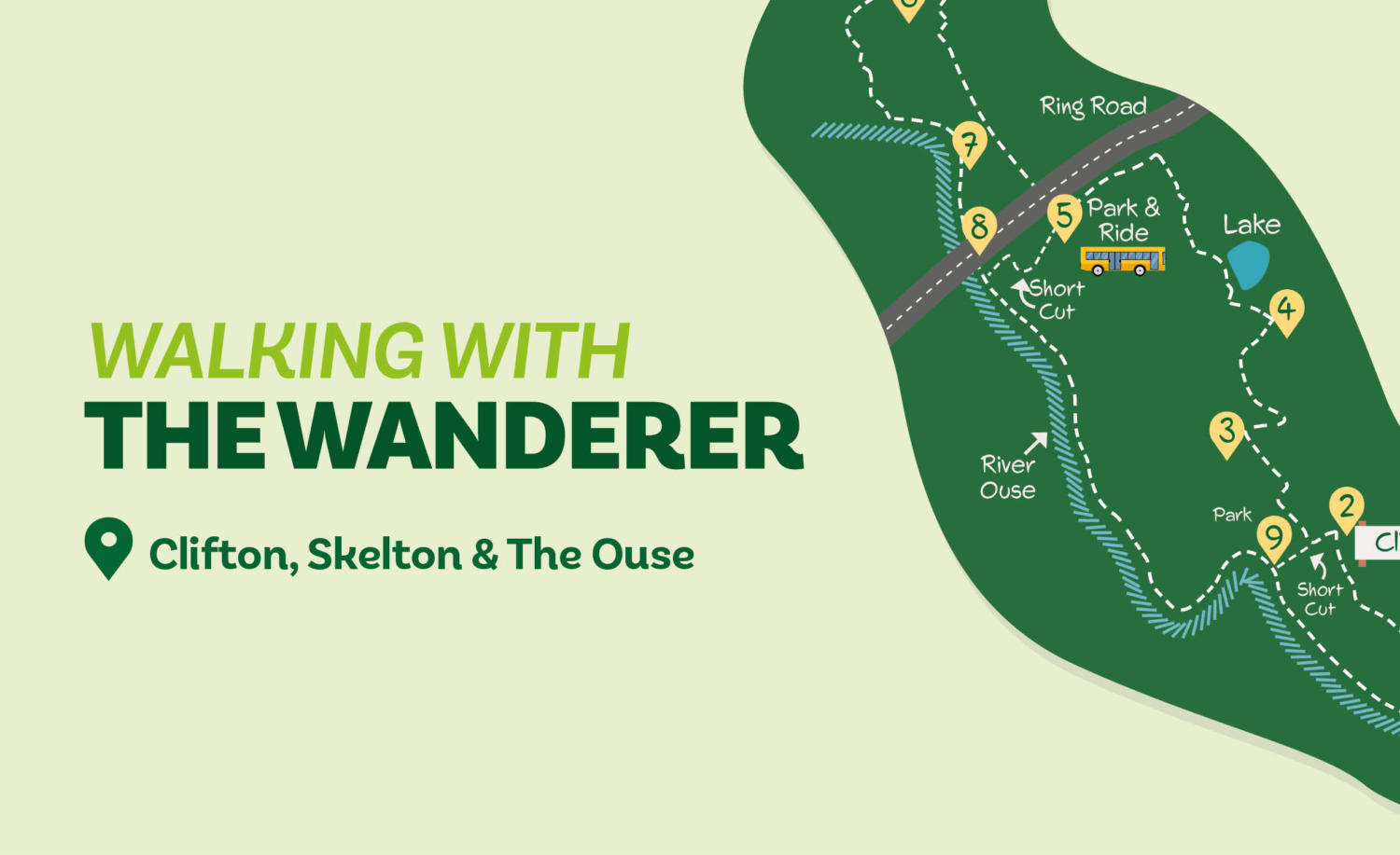
Starting from the city centre, this walk heads north-west, mainly using green corridors, to Skelton. It then heads for the river Ouse, following it all the way back to the start. If you haven’t got time for all four hours, the walk can be shortened by returning from Rawcliffe Park & Ride (see instructions at Direction Point 5). An even shorter option is to return to the city centre via the river from Clifton Green.
Is This Walk For Me?
The walk is long but otherwise undemanding, with much of it on hard surfaces. At times when the river is high, sections of the walk from Direction Point 6 will be impassable.
Getting There
Several bus routes stop near Exhibition Square while the nearest long stay carpark is Marygate. The walk could also begin from Rawcliffe Park and Ride which is accessible via the no. 2 bus.
Refreshments
There are numerous opportunities in or near the city centre. If you do get peckish en route there’s the Lysander Arms at Rawcliffe and Riverside Farm on the road to Skelton.
What To See
There are back routes a-plenty on the way to Rawcliffe as well as one of the city’s best parks — featuring a hidden lake.
Download your FREE digital walk map!
Directions
1. You’ll start off facing the art gallery — once you’re opposite, take the passage to its’ right. Then cross the paved area to the left and walk through the edible garden. Follow the path towards the ruins and join a path that comes from the museum — you should find yourself going down a slope. Next turn right at the path and exit the gardens, you’ll cross to Marygate Lane. Make sure to keep the carpark on your left and go under a bridge. Then cross a road ahead that is guarded by railings. Maintain the same direction with the school buildings to your left until you reach a narrow path between railings. Follow this until you come across a grassy area in front of a large tree, at this point fork right on an earth path, keeping the gardens to your left. Then cross a road and continue on a narrow path to Clifton Green.
2. Next turn left towards some pedestrian lights — go left for 30 metres so that you can enter Homestead Park. Walk through the park whilst ignoring all pathways left until you reach an access road. Here, turn right and exit through the carpark. Then turn left on the road for 250 metres until you see Malton Way on the right.
3. Go down this pleasant street and turn left onto Rawcliffe Lane. Continue for about 600 metres, passing a mini roundabout and two zebra crossings. Beyond the second zebra turn left towards Beaverdyke.
4. Continue until you reach a T-junction, at which you’ll turn right. Where the street ends, go ahead to a gate. Then take the path left with the lake to your right. At the lake end, keep left, where you’ll find metal barriers. Turn right at the junction and pass over a wooden bridge (signed Rawcliffe), then follow the path alongside the playing field. Enter a carpark but go left by barriers into a grassy strip. Follow the path as it curves, keeping right at a divide to reach an ‘End of Route’ sign. Then turn left towards the main road.
5. Turn right. (To shorten the walk, cross the road to the Park & Ride site. At the bus stop go left of the building, taking the path ahead into trees. At the track, turn right following it towards the bridge. As you approach go ahead — not right — over a broken stile to an embankment at which turn left to continue from Direction Point 8. Go through the underpass and continue alongside the main road. You should be approaching Skelton, and with Ousebank Drive on the opposite side of the road, pass through a hedge gap and take a tarmac path with a pond to your left. At the street, turn left towards a junction. Then turn right and continue until you reach a grassy area on the left, with a path leading left at a noticeboard. Follow this beside the grass to a road. Then turn left, passing the church and keeping on the village street to reach the main road.
6. Cross the road and turn left for 30 metres, then turn right down a narrow lane (signed ‘Overton’). Just after the road dips, take the cycle track left (signed ‘York 4’). Follow the track as it curves crossing a metal bridge, you’ll reach the river on the right. At a house, turn left on the track away from the river.
7. Beyond the houses take the signed cycle track right which curves back to the river. Continue to a kissing gate. About 40 metres beyond this at a grassy area, go right and walk over the floodgates —then curve left on the embankment. Continue along the embankment and go under the large road bridge.
8. Now keep on the riverside path atop the embankment. After another kissing gate, continue alongside the river, which eventually curves sharp left, for about a mile to reach floodgates. Once you’re over these, take the tarmac path at the bottom of the bank. Continue through a wooded area until you reach Clifton Bridge.
9. Follow the riverside path under the bridge with playing fields, then a grassy area, to the left. Continue under a railway bridge and through a stone arch to a metal (Lendal) bridge with the Museum Gardens left. At the bridge turn left up the cobbles. Pass the Museum Gardens entrance to reach the traffic lights. Finally turn left and you’ll return to Exhibition Square.
Disclaimer: Walks are undertaken at your own risk. Due care must be taken in following the walk, particularly after poor weather. Whilst every care is taken in compiling the description, some changes may have occurred since publication. Neither the walk author nor Your Local Link can accept any responsibility for any errors or omissions.









Add a comment