Time
6 miles 2½ hours
This gentle stroll visits the under-appreciated villages of Green Hammerton, Whixley and the surrounding countryside. The route is mainly on field paths and tracks with just over a mile on a country lane that carries very little traffic. Most of the walk is waymarked and easy to follow. Where the route is less clear, points are underlined in the directions.
Getting There
The recommended starting point is the Bay Tree pub in Green Hammerton where there’s plenty of on-street parking. It’s also possible to park and start from Whixley. Green Hammerton is nine miles from York via the A59. Bus 22 runs approximately every two hours from Piccadilly and the railway station to both Green Hammerton and Whixley (no Sunday service). In Green Hammerton alight at the Post Office stop just before the Bay Horse pub.
Refreshments
There are pubs in Green Hammerton (Bay Horse) and Whixley (Anchor).
Directions
1/ With the Bay Horse pub behind you, go right down Boroughbridge Rd passing the village green to the right and Village Club to the left. Approaching the main road take the path to the right of the trees and cross the road to go along the left verge for 20 metres to a gate. Go through and walk along the left edge of the field to a footpath sign pointing diagonally right across the field. Keep well to the left of an isolated tree to find a gate in the hedge ahead to the left of a telegraph pole. Go through and continue on the same line across the corner of the next field to a further gate. Once through, keep in the same direction over another field to a gate visible in the hedge. Maintain the same line across a further field aiming just to the left of a white building.
2/ Go through the gate to the road. Now continue in the same direction (ignoring the two roads to the right and passing the Anchor Inn and village store) to go along High Street. Ignore a road on the left (Stone Gate) but soon after, opposite the village hall, go left up Church Street. Just after passing a left turn (Clockhill Field Lane) turn right up a signed footpath. Pass the church to the right to arrive at a gate.
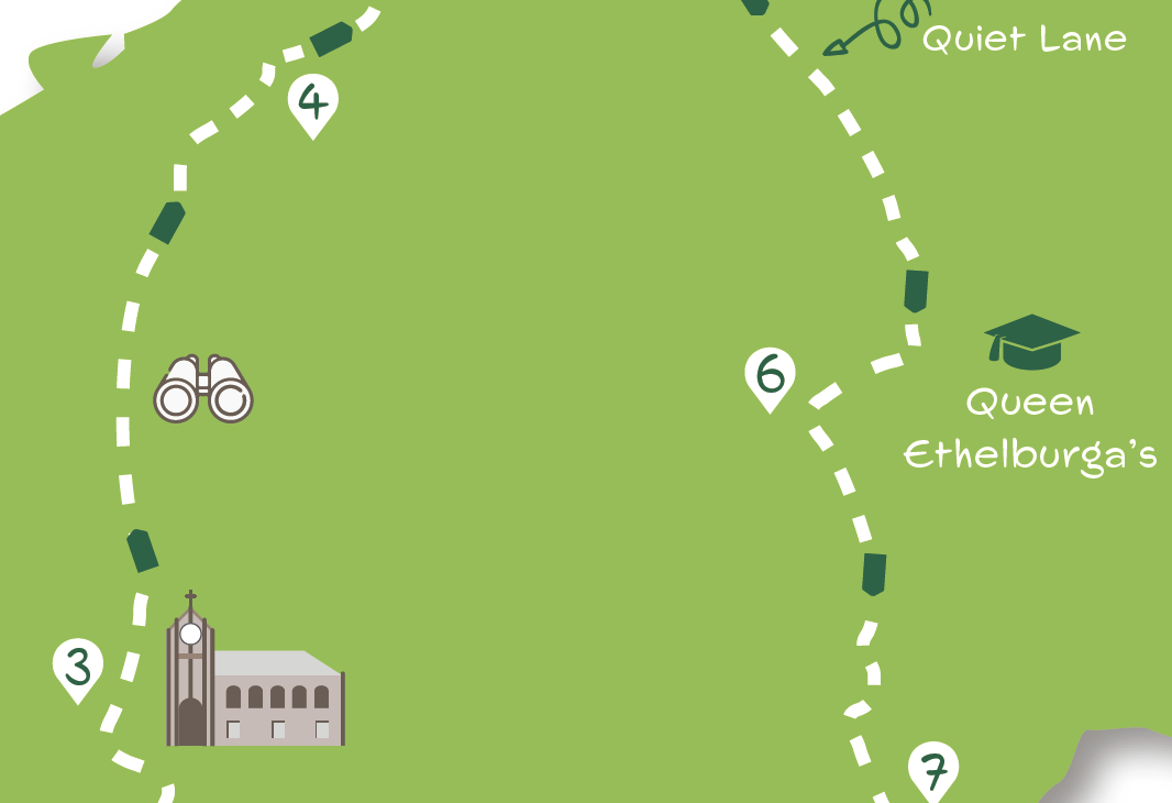
3/ Do not turn half right across the field as signed but go into the left field corner and walk alongside the hedge for 40 metres to find a gate. Go through and turn right on the other side along the right edge of the field. At the field end continue, now with the hedge and young trees to the left, passing through another gate to arrive at the left corner of a field. Take the obvious path in the same direction leading across a large field to a gate. Through this go slightly right across the next field to a gate in the hedge. Beyond, continue in the same direction towards a small pylon and go over the stile. Now veer half right towards a barn crossing a further stile into a small paddock. Exit this at a three way footpath sign over another stile. Go right, keeping just behind the barns on the right, to find a stile giving access to a surfaced track leading to the main road.
4/ Cross the main road into the field opposite and go left along its edge parallel to the road. At a footpath sign by the crossing hedge turn right on its far side away from the road. Go left at the next field corner but in 20 metres turn right as signed on an earth track downhill with a hedge to the left. At a path crossroads keep ahead, now between hedges. Where the track forks go left, still with hedges on both sides, and in about 350 metres arrive at a road by a T junction.
5/ Turn right at the junction (signed Thorpe Underwood 1¼). Continue on this quiet country lane which eventually narrows between high hedges. Ignore a junction on the left signed Thorpe Underwood Estate to continue on the lane passing the campus of Queen Ethelburga’s School on the left.
6/ At the end of the school complex, cross over a stile by a footpath sign on the left side of the road. Go along this enclosed path with a wall to the left, eventually arriving at a bridge over a ditch. Cross the end of the small field (no visible path) to a gap by a holly tree almost opposite. In the next field, go down the left edge (not half right as on the OS map) turning right in the corner with the hedge still on the left. Where the hedge ends go left over a footbridge and stile with a hedge on the right. Go over another stile ahead then come to a bridge and further stile.
7/ Maintain the same direction walking alongside an area of trees with a stream to the right. Where this ends, cross the ditch on the bridge and continue straight over the field ahead. Aim to the right of the nearest trees. Keep on the apparent path with a rough area and trees to the left aiming towards buildings ahead. Pass these to the left to go through a metal gate onto a tarmac lane. Turn right, follow the lane round a left bend and continue down the village green to arrive back at the centre of Green Hammerton on Boroughbridge Rd. Turn left to return to the Bay Horse.
What to See
Since the bypass, Green Hammerton is a pleasant village with less traffic. Its most attractive feature lies off the main road, the long village green flanked by several period houses. Whixley has a similar array of period buildings, many old farmhouses, especially on High Street. The Church of the Ascension, tucked away at the end of the village, dates from the fourteenth century. Good views over the Vale of York to the North York Moors and the Wolds can be had on the route approaching and leaving Whixley. Later the walk skirts the grounds of Kirby Hall. The original hall was mostly demolished in 1920 but parkland and a lodge remain. Another feature of the walk is the extensive campus of the private school, Queen Ethelburga’s College. Its main building, the present Thorpe Underwood Hall, was designed by York architect Walter Brierley. Thorpe Underwood also has Brönte connections, both Anne and Bramwell having resided in the hamlet for a few years.
Disclaimer
Walks are undertaken at your own risk. Due care must be taken in following the walk, particularly after poor weather. Whilst every care is taken in compiling the description, changes may have occurred since publication. Neither the walk author nor Your Local Link can accept any responsibility for errors or omissions


Linda Nelson
11 May 2021 at 13:51In section 3, we opened the gate to be confronted by a barrier to the field and a notice to say that there was a bull in the field. There were certainly cattle, laid down so we circumnavigated the field on the outside to access the main road. At the end of section 6 there was no footbridge, so we went through the farmyard and had lunch at Tankred Farm (to be recommended).
Linda Nelson
11 May 2021 at 13:57It would be useful if section 7 is included in the free print off.
Add a comment